Future Tense

Swedish Island That Looks Like a Van Gogh Painting Wins NASA’s “Earth as Art” Contest

Gotland, a Swedish island in the Baltic Sea

A phytoplankton bloom off the coast of Gotland, a Swedish island in the Baltic Sea, conjures Van Gogh’s “Starry Night.”

NASA’s Goddard Space Flight Center/USGS

To mark the 40th anniversary of the Landsat program, NASA has been publicizing some of the best of the millions of images of Earth taken by the Landsat satellites over the years. Most of them are, frankly, depressing. Impressive, important—but dispiriting, in that they show just how quickly we’re degrading what’s left of the planet’s natural environment.

Take these time-lapse images of the Aral Sea, the once-vast saltwater lake that borders Kazakhstan and Uzbekistan. Formerly home to a thriving fishing industry, the lake has shrunk so much due to irrigation projects in the surrounding desert that it is no longer a single lake but a ragtag collection of much smaller lakes and, increasingly, bone-dry seabeds.

Similarly alarming is the sprawling growth of Las Vegas and the corresponding shrinkage of nearby Lake Mead, which supplies the desert metropolis with water. And time-lapse images from the Amazon show how roads beget farms, which beget more roads and farms, with the once-virgin rainforest vanishing in their wake.

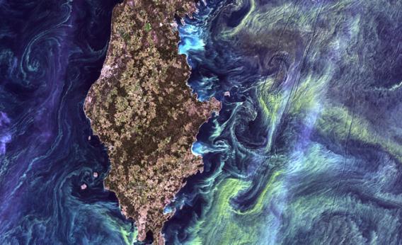
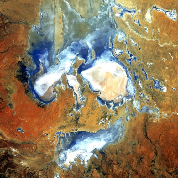
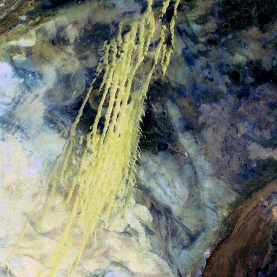
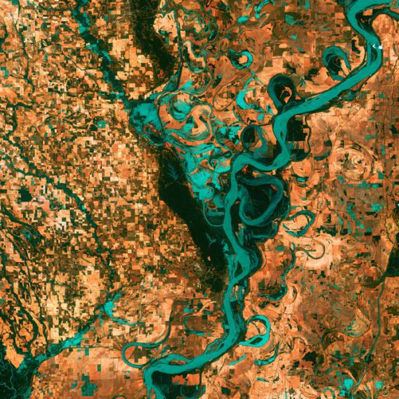
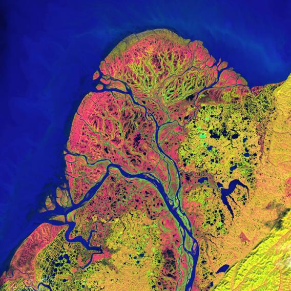
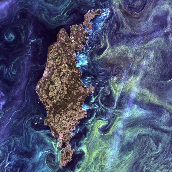
But that’s all old news for anyone who’s been paying attention. So let’s focus instead on a less-gloomy aspect of the celebration: the “Earth as Art” collection, a series of Landsat images digitally colored in by the U.S. Geological Survey to highlight their aesthetic appeal. Out of more than 120 images, NASA and the USGS asked the public to vote on the top five. Here they are, in order from fifth to first.

Lake Eyre
The scary face in this image is actually inundated patches of shallow Lake Eyre (pronounced “air”) in the desert country of northern South Australia. An ephemeral feature of this flat, parched landscape, Lake Eyre is Australia’s largest lake when it’s full. However in the last 150 years, it has filled completely only three times.

NASA’s Goddard Space Flight Center/USGS

Erg Iguidi
What look like pale yellow paint streaks slashing through a mosaic of mottled colors are ridges of wind-blown sand that make up Erg Iguidi, an area of ever-shifting sand dunes extending from Algeria into Mauritania in northwestern Africa. Erg Iguidi is one of several Saharan ergs, or sand seas, where individual dunes often surpass 500 meters (nearly a third of a mile) in both width and height.

NASA’s Goddard Space Flight Center/USGS

Mississippi River
Small, blocky shapes of towns, fields, and pastures surround the graceful swirls and whorls of the Mississippi River, the largest river system in North America. Countless oxbow lakes and cutoffs accompany the meandering river south of Memphis, Tennessee, on the border between Arkansas and Mississippi.

NASA’s Goddard Space Flight Center/USGS

Yukon Delta
Countless lakes, sloughs, and ponds are scattered throughout this scene of the Yukon Delta in southwest Alaska. One of the largest river deltas in the world, and protected as part of the Yukon Delta National Wildlife Refuge, the river’s sinuous waterways seem like blood vessels branching out to enclose an organ.

NASA’s Goddard Space Flight Center/USGS

Gotland starry night
In the style of Van Gogh’s painting “Starry Night,” massive congregations of greenish phytoplankton swirl in the dark water around Gotland, a Swedish island in the Baltic Sea. Population explosions, or blooms, of phytoplankton, like the one shown here, occur when deep currents bring nutrients up to sunlit surface waters, fueling the growth and reproduction of these tiny plants.

NASA’s Goddard Space Flight Center/USGS

All photos and captions are courtesy of NASA’s Goddard Space Flight Center and the USGS.