David Freese hadn’t considered an East Coast version of his book West Coast: Bering to Baja, a dramatic look at the West Coast of North America from the ground and from the air. That changed in 2012 when Superstorm Sandy struck and Freese visited New York and New Jersey. Once he saw the devastation, he decided to begin a project that showcased how the rising waters were affecting cities, islands, national parks, and national wildlife refugees through aerial photography on North America’s eastern shore (there are also images taken from the ground). The work, published as a book titled East Coast: Arctic to Tropic, will be released in November.
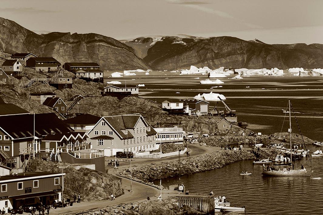
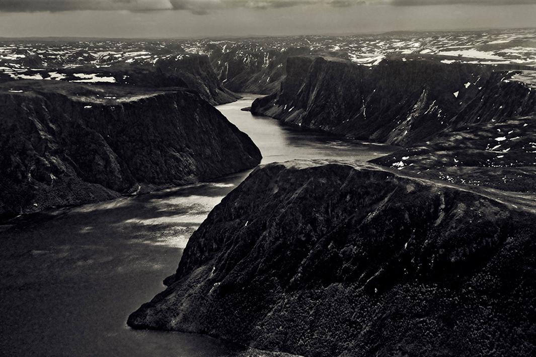
If you’re going to tackle another ambitious and expensive project, the best place to save on both time and money is on Google Earth, “without a doubt my greatest travel aid,” Freese wrote via email. He was able to scout locations and charter companies that would help him get to remote locations in Greenland and Canada, including the Torngat Mountains on the northern tip of Newfoundland and Labrador.
Freese said his goal was to find photographs that would “add or relate to the story of climate, weather, geology, and human impact” and about the “profound interconnections within nature and the effects of civilization.”
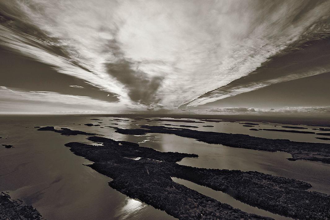
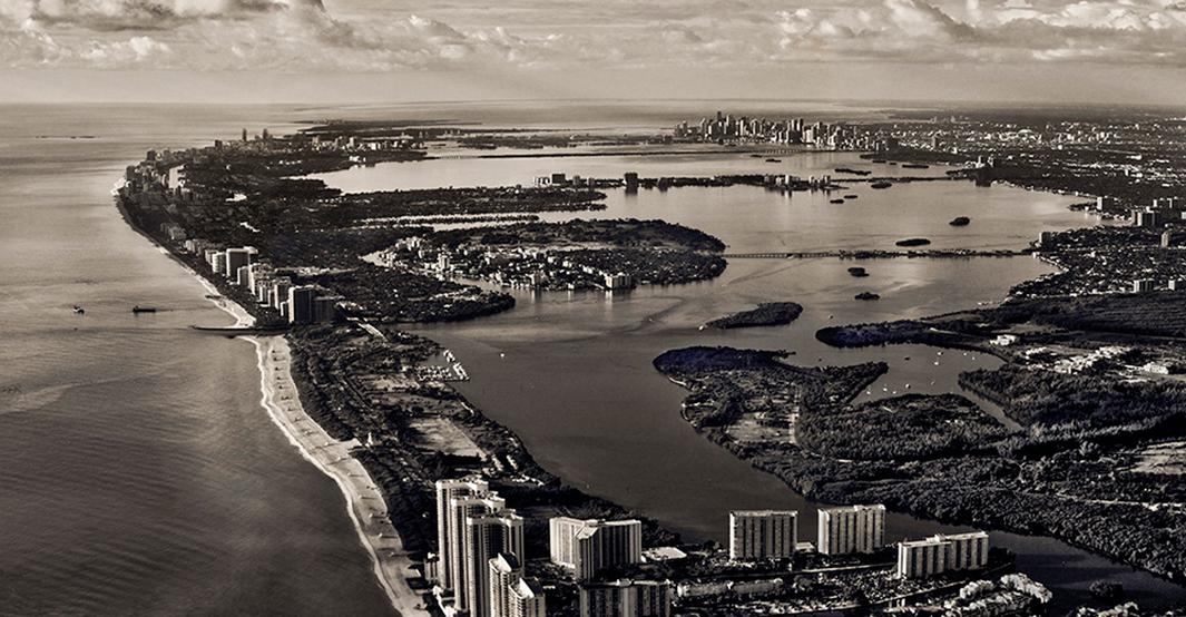
He spent time over cities including New York, Boston, Washington, and Miami, as well as a lot of “nooks and crannies” in between. As he journeyed down to the Florida Keys, what he saw from the air was shocking.
“Once I took to the air for the view from above, our precarious situation becomes immediately and forcefully evident,” he wrote.
David Freese
David Freese
David Freese
David Freese
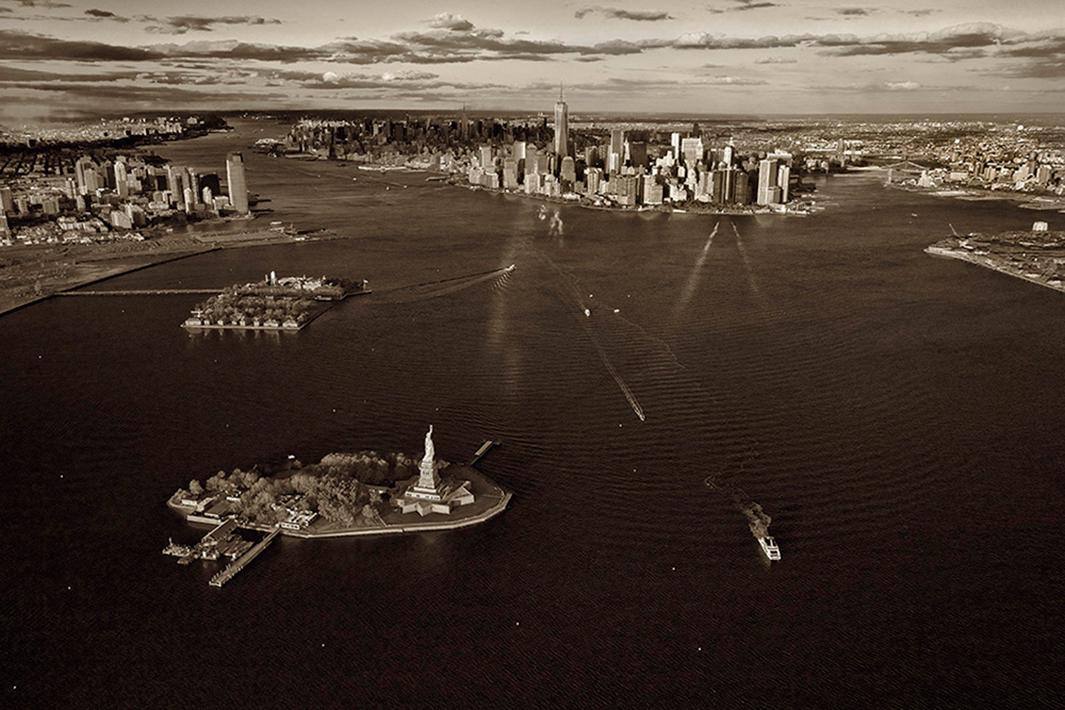
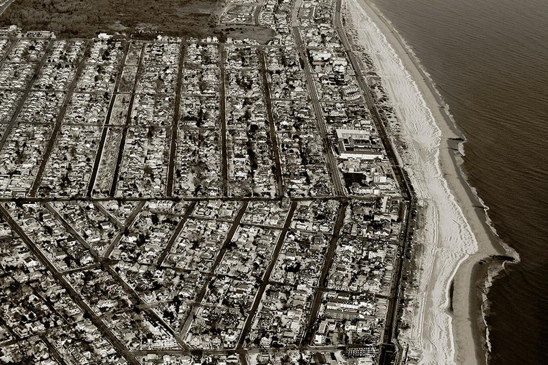
Freese added that our connection to water while we are on the ground is radically different from what we can see from the air. In New York City, for example, Freese feels we take for granted the city’s relationship to the sea “other than a general awareness that there is a river and a harbor with a Statute of Liberty that leads out to the ocean.”
“But, once in the air, the true relationships of land and sea come into full view—Manhattan fully seen as an island, Staten Island surrounded by water, bays and inlets in all corner, the Arthur Kill waterway with strips of land and marshes near chemical and oil refineries alongside a thundering New Jersey Turnpike.”
“Everywhere water is seen at the brim and we witness a population with nowhere to go when the sea moves up and in as we saw in Hurricane Sandy,” he wrote.
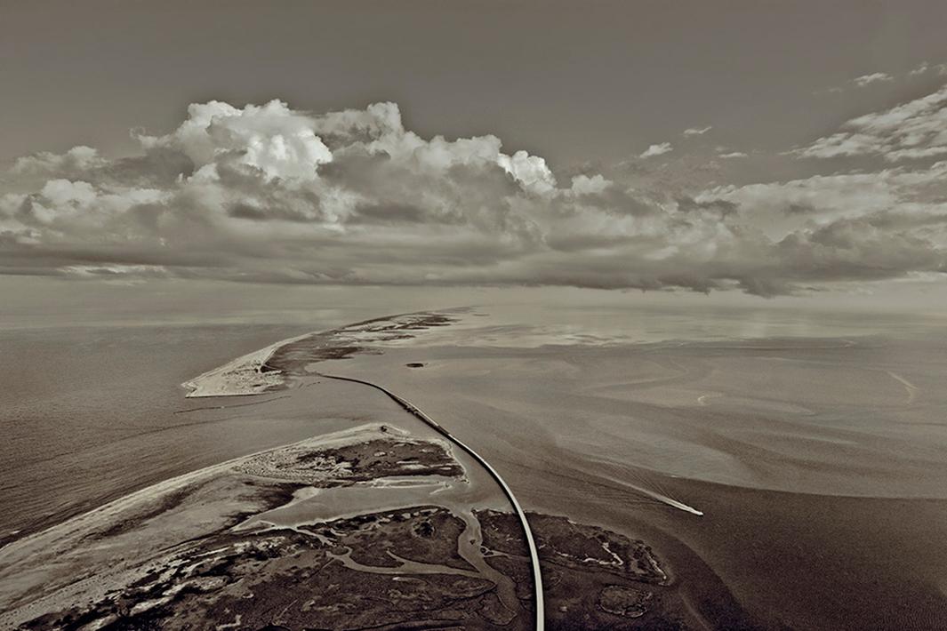
He said the fragility of the 1,300 miles he covered along America’s coastline is staggering.
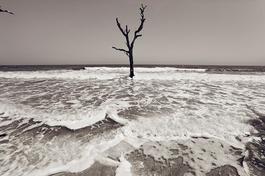
“There is also a wondrous beauty to the shapes and forms of both the natural and the built up world,” he wrote. “The resulting paradox is fully bewildering as much of this land will, soon enough, be underwater.”
David Freese
David Freese
David Freese