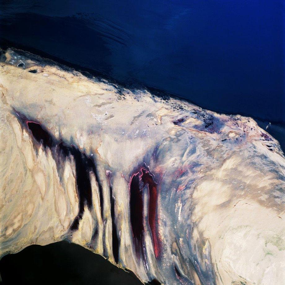
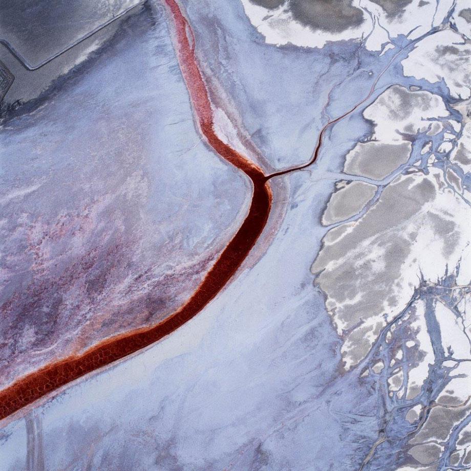
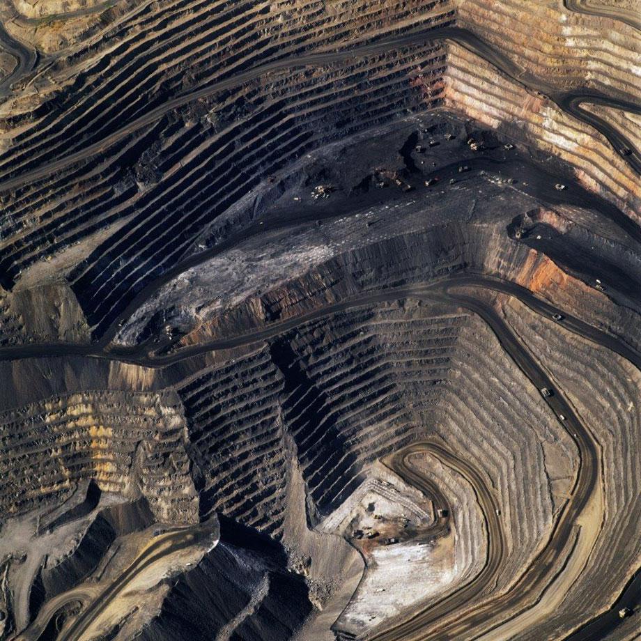
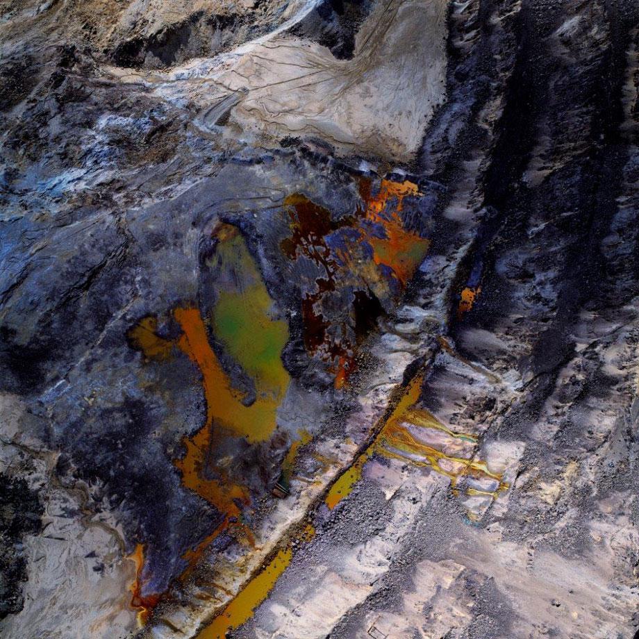
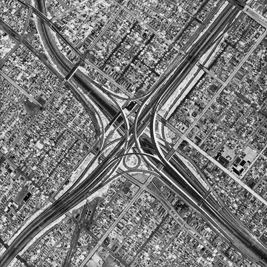
There is an overwhelming sense of disbelief when looking at David Maisel’s aerial photographs of open-pit mines, toxic waste sites, logging, freeways and other scenes that mark the toll humans have left on earth.
But the images found in Maisel’s recent book Black Maps—American Landscape and the Apocalyptic Sublime, published by Steidl, are all unaltered photographs of landscapes and the endless array of colors and strange patterns are abstracted visions of environmental devastation of land.
Maisel first went up in a plane in 1983 over Mount St. Helens with one of his teachers, photographer Emmet Gowin. Because he had initially studied architecture, Maisel felt comfortable looking at the land from a similar spatial perspective.
David Maisel/INSTITUTE
David Maisel/INSTITUTE
Via email Maisel wrote about that first trip:
“It was a thrilling way to work, to see, and to make pictures. In a little Cessna, set against such a vast landscape, I felt like I became a disembodied eye. It was an act of pure seeing, or seeing with one’s entire body, if that makes sense. And that is what captivated me, more than the fact that I was in an airplane per se.”
As soon as Maisel returned from that trip, he began working from the air. He prefers to work in-depth at a given site, spending years with repeat visits and flights. Maisel wrote via email that he works “at many different elevations, since that becomes a compositional device, and as time unfolds over the course of months or years I can chart the changes to an existing environment.”
He continued:
“In a sense, that first flight at Mount St. Helens introduced me to the experience of the sublime, to a degree even greater than when working on the ground there. The level of destruction, transformation, and transmutation of the entirety of that vast landscape was profoundly disturbing, but also deeply captivating, seductive, and compelling.
“Over the years, as I’ve worked at different sites, those same feelings arise again and again. There is a kind of horror that gets twinned with fascination as I work above zones that have undergone radical environmental transformation. I don’t think that those feelings and responses decrease over time; every flight and every site is a new set of conditions. Indeed, I often don’t know exactly what it is that I am looking at, and that adds another level of unease. Why is this pond acid green? Why is this water blood red?”
David Maisel/INSTITUTE
Maisel foregoes prior visual knowledge of a site before choosing it, instead utilizing a combination of available research and instinct:
“In the current era of Google Earth and other mapping technologies, I’ve adapted my research methods to a certain degree. But I don’t want my research to be too predictive. I’d rather discover the site through my experience of it bodily than to feel like it has been divulged to me from a screen shot. For similar reasons, I’m not mining images off the Internet to create my work, nor am I particularly interested in drones that could make pictures remotely, at my command.”
In terms of future projects, Maisel, who has only thus far photographed sites in the United States, wrote:
“I want to expand the geographical boundaries to include sites around the globe. This summer, I’ll be working in Europe. And, of course, when the call comes to photograph on Mars, my bags will be packed.”
The touring exhibition of Maisel’s work, Black Maps, will be on view through May 11 at CU Art Museum, University of Colorado at Boulder, and then from June 1 through Sept. 1 at the Scottsdale Museum of Art, in Arizona.
David Maisel/INSTITUTE