I’ve been fortunate enough to visit the big island of Hawaii a few times; it’s a fantastically beautiful place and an amazing science destination. There’s a seahorse farm, astronomical observatories, volcanoes, and an eclectic selection of environments, from forbidding lava flows to dry forests to lush tropics.
The edges of the island are at sea level (duh), but the highest point, the peak of Mauna Kea, stretches to 4,200 meters (2.6 miles) above. That brings a lot change in temperature, as you might expect. I watched the sun set from Mauna Kea while I shivered even when wearing a parka; I had gotten used to 35° C humid days.
Still, perhaps the last thing you might expect to see in Hawaii is snow.
But it’s actually pretty common late in the year. The peaks of Mauna Loa and Mauna Kea are high enough that it can stay cold up there, and if moist air gets pushed up the slopes, it’ll condense and fall as snow.
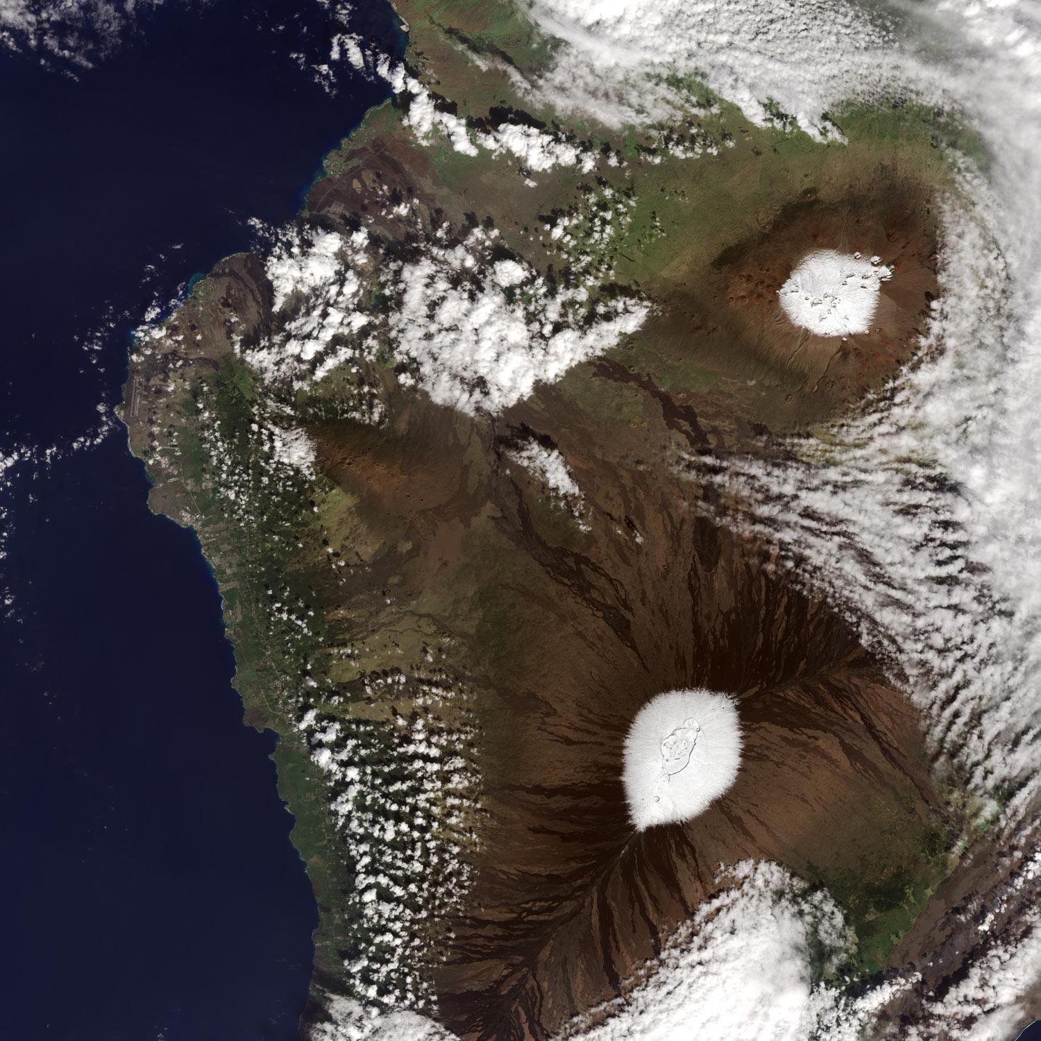
The image above is a lovely example of this. It was taken by the Landsat 8 Earth-observing satellite on Dec. 25, 2016, using the Operational Land Imager camera. It’s natural color, so what you see is pretty much how you’d see it if you were a few hundred kilometers above the volcanic peaks.
I love this shot; the wind was blowing more or less to the west, and you can see streamers of clouds stretching between the two huge volcanoes (Mauna Kea to the north, above, and Mauna Loa to the south, below) funneled into the saddle between them. The snow on both volcanoes is especially visible because the flanks of both are so barren at high elevation. Driving up the slope of Mauna Kea is like commuting across Mars; it’s a phenomenal vista with reddish-brown lava rocks everywhere.
Jesse Allen, using Landsat data from the U.S. Geological Survey
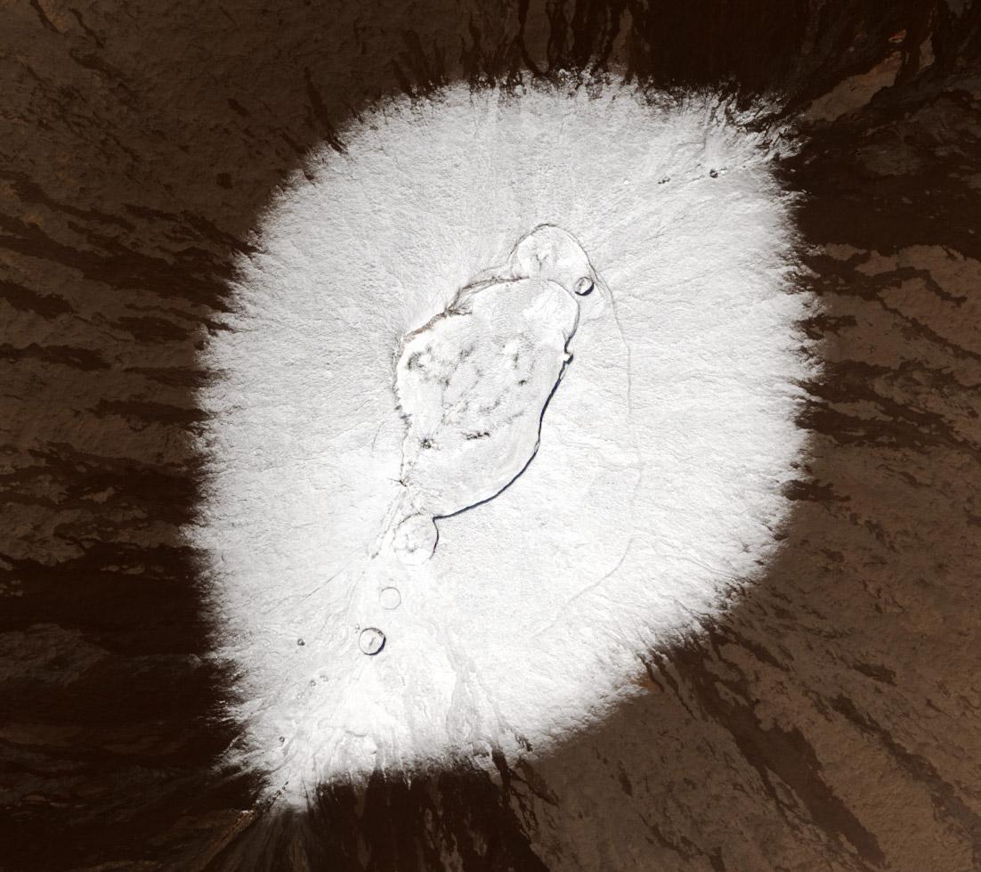
This is a closer view of Mauna Loa. The central crater (called a caldera) is actually three overlapping craters, collectively called Moku’aweoweo and for scale is about 6.2 km (3.8 miles) along its long dimension. The Sun is shining from the southwest (lower right) so you can see the steep southwest cliff of the caldera by its shadow. I love how the snow tapers off in all directions, feathery and light. The volcano itself actually sports more gentle slopes along its flank than Mauna Kea; its basaltic eruptions tend to be less viscous, so the lava flows more smoothly.
It must be somewhat surreal to stand in a Hawaiian snowstorm (though extremely irritating for astronomers who probably have waited all year to get observations from the world-class observatories on Mauna Kea). Our planet never ceases to amaze me.
By the way, I saw these images at NASA’s fantastic Earth Observatory Image of the Day site, which you should immediately put into your bookmarks/RSS/whateveryouusetogetupdates. Trust me; you’ll not regret it.