We live in the future.
As proof, I present two new services: UrtheCast and Skybox. Both are cameras in space pointed down at Earth that provide high-resolution nearly-live views—including video—of our fair planet.
UrtheCast was launched into space in November 2013. It consists of two cameras mounted on the outside of the International Space Station—yesterday two Russian astronauts performed an EVA to install them, but unhappily there was a problem, and no telemetry was received from the ground. I hope they can find the problem and fix it soon.
Assuming they do, this will be quite a cool project; the still camera has 5-meter (16 feet) resolution, and can take images of strips 40-kilometers (25-miles) wide. The video camera has 1-meter resolution (using a 4k chip!) and can take up to 60 seconds of footage. There are different levels of service, but you can sign up for free to get access to the basic images. The premium service will allow for people to respond to events as they occur (say, natural or human-made disasters) and get near-real-time images and video.
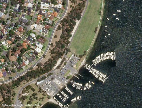
The other new venture is Skybox. Unlike UrtheCast, Skybox is a free-floating satellite. Launched by ISC Kosmotras in November 2013, it’s small, only about a meter on a side and massing about 100 kilograms (220 pounds). There have already been pictures returned from orbit, and now there’s even HD video:
Skybox has meter-scale resolution on the ground as well. The planned constellation of satellites will eventually total 24, and they sell the data to users much like Urthecast. I’m no businessman, but I’d think the financial models of these ventures look good (else getting investors would be pretty hard). I do think there’s a great market for this, including just folks with a little cash who want access to images from space. But these data could also provide rapid nearly real-time data in emergencies, long-time baseline observations of various activities on Earth (sure, for intelligence purpose, but also to see how, for example, farmland and forests have changed as our climate changes, and so on), and many things we may not have even thought of yet.
People are clever. Give them the data, and they’ll find interesting ways to use it.
I’ll note some people will be nervous about cameras in the sky looking down all the time. I can understand that feeling, but it’s a bit late; we’ve been spying on ourselves for more than 50 years. These images, at least, are openly available.
And I do support more and higher-resolution observations of Earth. Like it or not, we’re changing this planet, on both small and massive scales. I like the idea of more eyes in the sky able to keep track of this geoengineering. Like any tool, something like this can be used for good and for ill. Keeping track of the ill is good.
