I’m in the habit of clicking on any picture Commander Chris Hadfield tweets. After all, he’s taking them from orbit, as he circles the Earth in the International Space Station. That, in general, means every shot is probably worth a closer look.
I’m really glad I clicked on one he posted on Apr. 20, 2013. His caption was, simply, “St Lawrence’s mouth, where the Great Lakes pour into the sea.” The St. Lawrence runs to the northeast from the Great Lakes, going through Ontario and Quebec before running out into the north Atlantic. It’s gorgeous, but as you might guess (since I’m posting about it) there’s more here than meets the immediate eye:
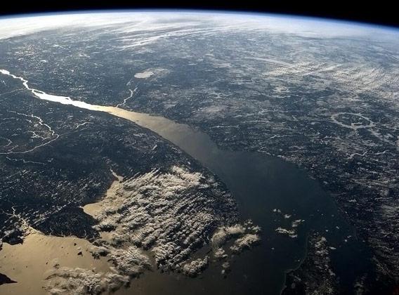
Image credit: NASA
Stunning, especially the sunlight reflected off the mighty river. To give you a sense of scale, the area where the river widens suddenly in the picture, to the right of the cloud bank, is about 80 kilometers (50 miles) across. It’s big.
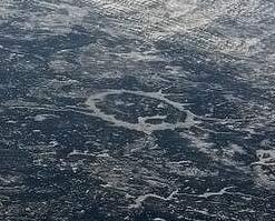
Image credit: NASA
But look again. To the right, see that big circle, like a giant Q stamped into the land? It looks like a circular lake, or, to be more accurate, an annular (ringlike) one. But that’s no ordinary lake. That’s the Manicouagan impact crater.
A little over 200 million years ago, an asteroid or comet the size of a small mountain (maybe five or so kilometers across) slammed into the ground about 200 kilometers north of where the St. Lawrence is now. The impact was massive, and left a complex, multi-ringed crater over 100 km (60 miles) across. The lake is actually filling the inner ring, which is about 70 km (40 miles) across.
Here’s an image taken from directly above, showing the crater without the distortion due to the low viewing angle of the first picture:
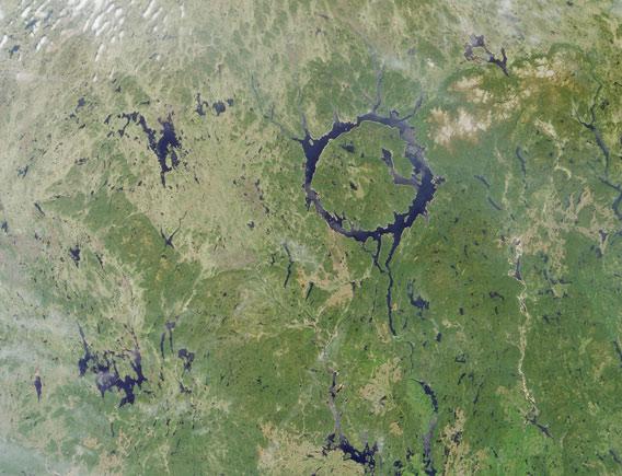
Image credit: NASA/GSFC/LaRC/JPL, MISR Team
That was taken using NASA’s Terra satellite in 2001. As you can see, the inner water-filled ring is nearly a perfect circle. The rock just outside it is pretty tough, so it resists erosion. That’s why we can see this crater at all; most craters this age on Earth have long since disappeared. It’s also why the Moon is covered in craters, but Earth only has about 200 catalogued impact craters.
Only craters that are very large or very well preserved (or both) can still be seen on Earth, a testament to how rare really big impacts are. Heck, the Chicxulub impact crater, marking the impact site of the rock that wiped out the dinosaurs, was only discovered in the 1970s because it’s so big and heavily eroded. Even then, its discovery was something of an accident.
Looking from the ground you’d never know Manicouagan was an impact crater, but from space its identity is pretty clear. It’s another reason space travel is so important; it literally gives us a new perspective on our planet.