The Landsat fleet of Earth-observing satellites lives! The newest bird in the flock is temporarily named Landsat Data Continuity Mission (LDCM)—in May it will be handed over from NASA to the USGS and will be officially renamed Landsat 8.
Landsats have been looking down on our lovely planet for more than 40 years. LDCM just opened its eyes a few days ago, and sent back some fantastic “first light” pictures, including my own beloved home town of Boulder, Colorado taken on Mar. 18, 2013:
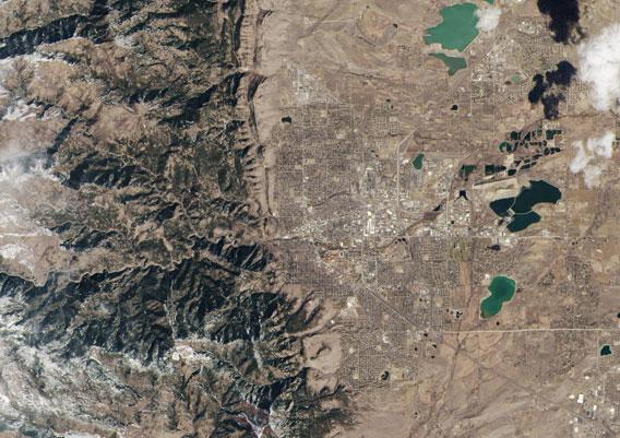
Image credit: USGS/NASA Earth Observatory
Cooool. They picked Boulder in part because it’s where Ball Aerospace is located, the company that built the Operational Land Imager—the visible camera—on LDCM.
But also, Boulder is a really cool place. The Rockies pushed up through the crust over the course of 30-80 million years ago. Before that, the entire middle of the U.S. was an inland sea. The mountains created a bulge in the middle, so even though the Midwest is flat (it was a seabed), it’s tipped. Driving west from the central states is essentially all uphill. It’s amazing how flat eastern Colorado is, right up until you hit the mountains, which come out of the ground like a fist.
Right where I live is one of the most sudden changes in topography on Earth, and the view is magnificent. Even from space.
The image above shows a region about 25 kilometers (15 miles) across. I’ve ridden my bike farther than the borders of this picture from my house! Well, not to the west, though I tried once and suffered the consequences of an 800 meter vertical rise over a few kilometers of run while already 1700 meters above sea level. It took me three days to catch my breath.
The detail is incredible, and yes, my house is somewhere in this picture. I’ll give you a hint: I’m to the right of the mountains.
There is an infrared imager on LDCM as well, and it took this image of the Ft. Collins area, to the north of Boulder:
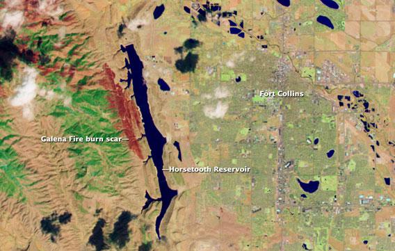
Image credit: USGS/NASA Earth Observatory
It’s false color; but the burned land from the recent Galena fire is easily visible. Images like this will help scientists understand how the land is affected by fire, weather, human influence, and more. There’s a nifty visible/infrared slider image on the NASA site, too.
My congratulations to everyone involved with getting this satellite into the sky and operating, and I’m looking forward to many years of gorgeous and scientifically useful views of our lovely world.