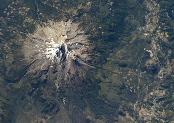
The Cascade range of volcanoes is pretty impressive to see from the ground. Stretching from California up to Washington, it includes famous mountains like St. Helens, Hood, and Rainier. I’ve seen many of these while driving in the area, and they’re even cooler from an airplane.
But I have to say, the view from the International Space Station might be best.
This shot was taken from the ISS on Sept. 20 and shows the region around Mount Shasta, a 4300-meter peak in northern California. It’s technically dormant—it erupted last in 1786. In geologically recent history it’s erupted every 600 years or so, but that’s not a precise schedule, so geologists keep an eye on it, as they do many of the peaks in the Cascades. As well they should.
To the west of the mountain (to the right in the picture, near the edge) is the much smaller Black Butte. I only point that out because you can see a highway winding around it to the right. That’s I-5, a major north-south highway, and a few years back when my family lived in Northern California, I drove it on our way to and back from Oregon. Black Butte was a pretty impressive lava dome, looking exactly what you expect a volcano to look like. And looming in the distance was Shasta, but more standard mountainy looking. That appearance is, of course, quite deceiving.
I love volcanoes, and I’m fascinated by them. I’m hoping to visit some more very soon. And I’ll have some news about that, I think, in the near future.
