In January through April of 2002, the Larsen B ice shelf collapsed in the Antarctic.
This was a huge sheet of ice, about 3250 square kilometers (1250 square miles) in area, roughly equal to a square 57 km (34 miles) on a side. There had been a series of warm summers that weakened the shelf, and then the very warm summer of 2002 spelled doom for it.
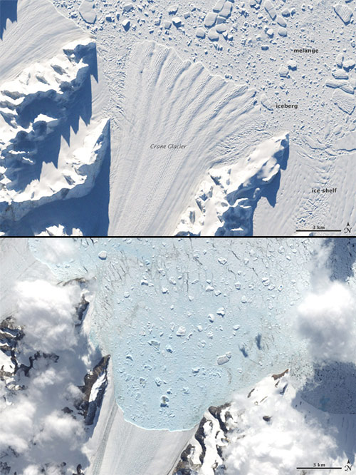
The Landsat 7 satellite took many images of the collapse, but the Earth Observatory Image of the Day just released two dramatic shots of its impact:
 The top image was taken on April 6, 2002 – about two months after the shelf collapsed – and the bottom one on February 20, 2003. What you’re seeing is the Crane glacier which flowed out into the ice shelf. See how the end of the glacier has retreated so far back into the bay? The Larsen B ice shelf helped stabilize the glacier, but with the shelf gone, the glacier was free to break off as well. The end result is the glacier edge effectively retreating up the channel. You can see icebergs floating in the bay, some hundreds of meters across.
It’s hard not to wonder about climate change when looking at this. As we reality-based folks are fond of saying, weather (short-term, local environment) is not climate (long-term, larger environment). On the other hand, how many episodes of weather over how large a region does it take to add up to climate?