When Malaysia Airlines Flight 370 went missing this past March, Slate asked me to cover the peculiar news event. I happily obliged. Two days after my first piece ran, the story took a remarkable turn. The Malaysian government announced that signals received by Inmarsat indicated that the plane had wound up somewhere on a broad arc running from the southern Indian Ocean to Central Asia. The consensus reaction to this stunning news was that it had most likely gone south, into the sea. I weighed the evidence and filed a story arguing that it had more likely gone north. My editor was skeptical. Publishing my claim meant going out on a limb, but I felt that it was a risk worth taking. To ease her concerns, I promised that if I turned out to be wrong, I would write a public apology.
This is that apology.
To be fully honest, I am not super sorry to have blown the call. As Paul Krugman observed last Friday in a mea culpa of his own, there are degrees of wrongness. Krugman differentiates mistakes that arise from a fundamental error in one’s model from those that spring from simple bad luck. In fact, I would put my own mistake about MH370 into a third category: mistakes in which one knows that one has erred but can’t say why.
As I wrote last week, Inmarsat has by now leaked enough clues about MH370’s electronic Inmarsat “handshakes” that outsiders can now understand why, mathematically, the plane must have gone south. Yet we still have not a single clue as to what sequence of events might have taken it there. MH370 looks to be a unique case not just in aviation history. No machine this big, no group of human beings this large, vanished so completely and so mysteriously since the advent of modern technology. What’s more, MH370 didn’t just disappear once, but three times.
The first disappearance, of course, was when it vanished from air traffic controllers’ screens in the early morning hours of March 8, apparently after someone turned off its transponder and automatic status-reporting equipment, and took a hard left turn. Based on the speed and precision of its navigation, the plane almost certainly was under human control.
The second disappearance occurred about an hour later, as the plane slipped beyond the range of military radar. Minutes later, some kind of unknown event caused the plane to transmit a mysterious triple burst of electronic signals to the Inmarsat satellite. At around the same time, the plane took another radical course change, pivoting from a northwest heading toward mainland Asia to a southwestern course that would take it over western Indonesia and out into the open ocean. Based on the slim evidence of subsequent Inmarsat pings, the plane seems to have flown in a simple straight line, so it may not have been under human control at that point.
Then it disappeared a third and final time, this time leaving not a single clue.
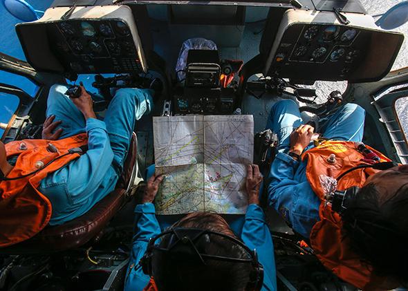
What has made the case so difficult to understand isn’t just the scarcity of information concerning its fate, but the superabundance of false clues. In the months that followed the disappearance, I had a front row seat to the flood of bad data. The day my first piece for Slate came out, I was asked to go on CNN, and more or less every day for the next two months I went on air four to six times a day, helping to cover every twist and turn in the saga. (I’m still under contract to the network.) I’m well aware that CNN’s zealousness in covering the story has received its share of ridicule, but for me it was an exhilarating, wild ride, one I’ve likened to having a baby: You’re exhausted and overwhelmed, but at the same time possessed with the sense of being enveloped in an extraordinary and life-changing experience.
Day by day, new developments would come in from sources all around the world, and my fellow analysts and I would try to explain them on air, on the fly. Making our job harder was the fact that in breaking news, a certain fraction of the developments are going to turn out to be erroneous. What to make of reports that the plane had climbed to 45,000 feet after its initial turn, then precipitously dived (faster, it turned out, than the laws of physics would allow)? How excited should we be about the debris that satellites had spotted floating in the southern Indian Ocean (yet never was to be seen again)? How soon before searchers tracked down the sounds coming from the black box acoustic pingers (which turned out not to have come from the black boxes at all)?
The fog of misinformation was made worse by the Malaysian and Australian authorities. Faced with an ever-rising chorus of demands that they explain the search operation, they dragged their heels in releasing basic information, left simple questions unanswered, were slow to correct mistakes, and left huge gaps in the data that they did ultimately release.
The resulting uncertainty created a playground for amateur theorizers of every stripe, from earnest to wackadoodle. MH370 was a supermarket of facts to pick and choose from as one’s pet theory required. And the Internet gave everyone a chance to go viral in an instant. One of the more intriguing scenarios was put forward by Keith Ledgerwood, who posited that the plane had flown north and evaded radar by shadowing a Singapore Airlines flight. (The flight path turned out not to match the Inmarsat data.) Another that got a lot of play was the theory by Christian Goodfellow that the plane’s initial turn had been made because the flight crew was trying to get the burning airplane to an emergency landing in Langkawi, Malaysia. (Burning planes don’t fly for eight hours—though Goodfellow stands by his opinion )
Vehement passion was, alas, all too common as theories multiplied. I and everyone else who was publicly associated with MH370 was bombarded by emails, tweets, and blog comments offering evidence that solved the mystery once and for all. I soon formed a Pavlovian aversion to the name Tomnod, a crowdsourcing website that parceled out satellite images for the public to pore over. It was remarkable how many clouds, whitecaps, and forest canopies people could mistake for a 777 fuselage, and then proselytize for with deranged fervor. It always baffled me how people could get so attached to their ideas about an incident in which they had no personal stakes.
A confession: I, too, secretly had a theory as to what really happened to MH370. Detailed and complete, it included a perpetrator, an M.O., a flight path, a motive, and a destination. I was so swept up in the convincingness of my idea that I shelled out money from my own pocket for a researcher to do some digging overseas. I was careful not to discuss it publicly, since I knew it made me sound crazy, but as I worked out the kinks of the narrative, I became enveloped in the strange pleasure that one gets from letting one’s thoughts steep in the working out of something beautiful and complicated and true. This is right, I told myself giddily.
Well, suffice it to say that it all hinged on the plane going north. After I realized that it hadn’t, I spent the next few days eating more junk food and watching more TV than usual. Eventually I consoled myself with the thought that if I wasn’t right, at least I’d been able to let go. I wasn’t a wackadoodle.
Nor, as it happened, was I the only one to see my pet theory die. Across the Web, there has come to be a notable absence of coherent attempts at narrative. With Ledgerwood’s and Goodfellow’s theories debunked, no one has been able to come up with a replacement that fits with what eventually emerged as the canonical set of credible facts. To be sure, there’s still a vast army of believers, waving their Tomnod printouts and furiously typing half-literate emails about ACARS data buses. But each is a lone voice shouting into a sea of skepticism.
Even the small cadre of independent experts who have come together to decipher Inmarsat’s data seem to be at loggerheads. Each has made a tentative stab at interpreting the “raw data” released by the satellite company, but the unanswered questions remain so numerous that the group can’t form a consensus about the plane’s fate. The officials looking for the plane don’t seem to be doing much better; according to recent reporting by the Wall Street Journal, the team is riven by fundamental differences of opinion as to where it should look.
So to sum up, this is my mea culpa, and it’s a very tepid one. Yes, I was wrong. But so far—101 days in and counting—unfortunately, nobody can make a compelling case for what’s right.
Update, June 17, 8:50 a.m.: Today, the BBC is reporting that Inmarsat remains confident that its analysis of the satellite data will lead to the plane, saying that the authorities never searched the area of highest probability because they were distracted by the underwater acoustic pings that turned out not to have come from MH370’s black boxes. Once a new search gets underway, it will explore an area that conforms much better to the likely speed and heading of the missing plane:
By modelling a flight with a constant speed and a constant heading consistent with the plane being flown by autopilot - the team found one flight path that lined up with all its data. “We can identify a path that matches exactly with all those frequency measurements and with the timing measurements and lands on the final arc at a particular location, which then gives us a sort of a hotspot area on the final arc where we believe the most likely area is,” said Mr Ashton.
Unfortunately, it will be several months before such a search of this new area can get underway, since the authorities will first have to survey the ocean floor to figure out how deep it is and what kind of underwater exploration technology—autonomous sub or towed sonar array—will be most appropriate. Meanwhile, a spokesman for the Australian organization leading the search described a more complex and ambiguous state of affairs, telling the AFP that experts were still struggling to narrow down the highest-probability search area, taking into consideration not just the satellite data but also “aircraft performance data [and] a range of other information.”
This article is part of Future Tense, a collaboration among Arizona State University, the New America Foundation, and Slate. Future Tense explores the ways emerging technologies affect society, policy, and culture. To read more, visit the Future Tense blog and the Future Tense home page. You can also follow us on Twitter.