The first mission to the International Space Station was more than 12 years ago. In that time, from their perch 400 kilometers above Earth, astronauts have taken more than 1 million photographs. Nearly all of these photos have been archived on NASA’s servers.
In my spare time, I’ve crawled that archive, looking up the location of the ISS for each of the 1,129,177 astronaut photos that have been cataloged. (There are even more yet to be properly entered!)
Most of these images are of the same parts of Earth we like to look at when we’re standing on it. Coastlines, islands, and cities seem to be popular targets. So much so that it’s possible to make out a basic map just by drawing a dot at every point the space station was when a photo was taken.
This makes sense—clouds over a vast, blank ocean get old after a while. And I’m sure every astronaut has taken at least one photograph of the town he or she grew up in. Just to be sure it’s really a map, I added outlines of the continents under the dots, colored by mission to see who took photos where.
Breaking it out into individual maps makes it even clearer.
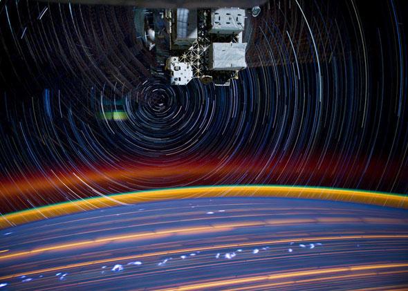
During Expedition 30/31, Don Pettit took dozens of amazing time-lapse sequences consisting of thousands of images taken continuously as the ISS sailed along its orbit. One can clearly see many dark lines appear during his time on station. In fact, he’s single-handedly responsible for almost half the images taken on orbit!
Because this data is from NASA, it is in the public domain. I’ve taken care to make the aggregated data public as well. All of it can be found on my github page.