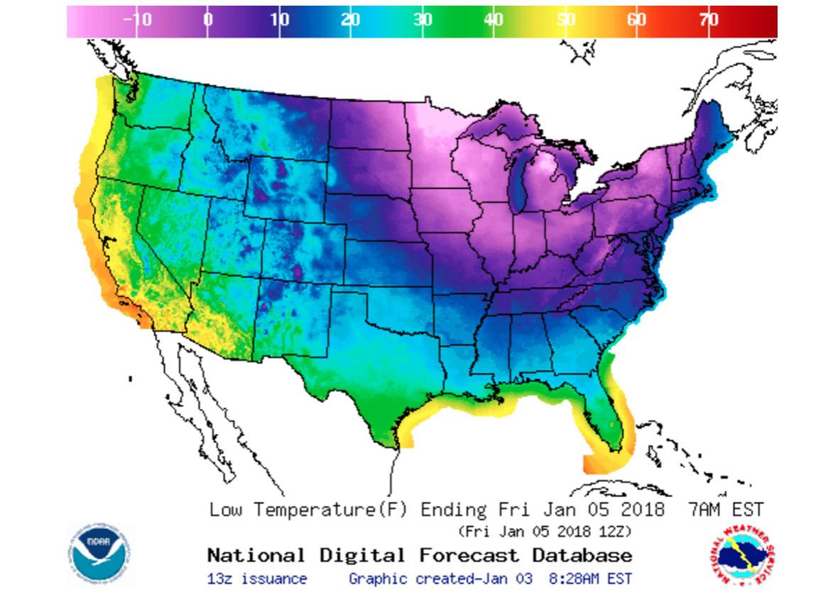
If you’re east of the Mississippi, you’ve probably noticed it’s been pretty cold outside. Boston hasn’t seen anything above 30 degrees Fahrenheit since Christmas. It isn’t much better in New York City, where temps above 30 degrees have been MIA since Dec. 26.
The cold has penetrated all the way to the Gulf of Mexico. A hard freeze earlier this week blasted across much of south central Texas. Tallahassee, Florida, had itself a winter storm warning and even got a little snow.
January is young, but Anchorage, Alaska, is averaging 15.7 degrees above average so far—a few days ago it was 37 degrees there.
What the heck has gone wrong?
Actually, nothing. It’s just winter. This cold is unusual but certainly not unheard of. We are simply at the mercy of the jet stream, the band of winds snaking at the edge of the tropopause. And this time of year the jet is strong. A New York–to–Los Angeles flight takes around six hours and 30 minutes these days. Flying the opposite direction with the jet on your tail, L.A. to NYC, figure about an hour and a half less.
The jet stream is the Interstate Highway System of weather. It guides storms and helps move air masses across continents and oceans. And it’s the guiding force behind Thursday’s East Coast snow and our return to ice-box conditions.
The jet itself is driven by the Earth’s uneven heat budget, with hot tropics and cold (though not matching) poles, and the Coriolis force, the frictional result of the Earth’s rotation. It’s often looks as if we have too much jet stream to fit as it snakes around the globe.
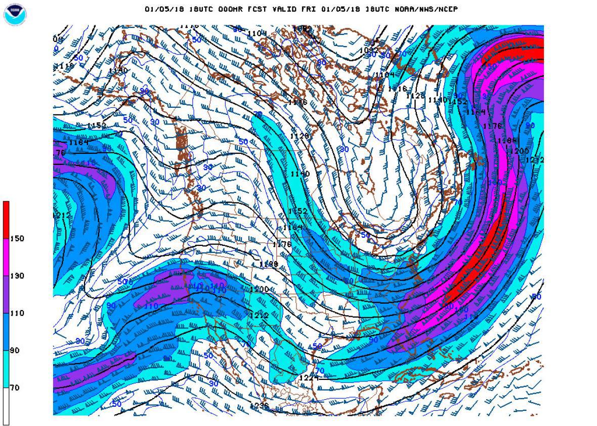
NOAA
This map from Thursday afternoon helps explain how the jet stream is affecting the temperature. There’s a ridge over the Western United States (look closely) and a deep trough across the East. So while the Eastern United States shivered under the jet’s trough, we West Coasters are enjoying mild temperatures. Please don’t hate us any more than you already do.
The jet undulates, reshaping itself on a fairly steady basis. It was tough to notice in the blizzardlike conditions, but Thursday was warmer than it’s been. But the jet will take care of that—the trough is deepening again. And unfortunately, it’s lather, rinse, repeat. The jet will do this to varying degrees for the rest of winter
By Saturday the jet stream will again connect the Arctic to the Eastern half of America. And, again, temperatures will plunge.
It would be nice if I could give you a definitive time winter will end, or at least break. It’s not quite that easy. Climatologically we’re past the first day of winter, the day North America gets its least amount of solar radiation. But, as we all know, that’s not normally the bottom of winter!
Most areas in the East still have another few weeks where average temperatures get colder. The Climate Prediction Center, the National Oceanic and Atmospheric Administration’s longer range forecasters, are still posting their Dec. 21 forecast for January/February/March. Though the Great Lakes will stay colder than average, the East Coast and South should cruise through the next 90 days with moderate winter temps.
Unfortunately, humans don’t live three months at once. We’re minute-to-minute beings. Over the next few days, as many areas see single digits, this will be very little comfort. Bundle up.